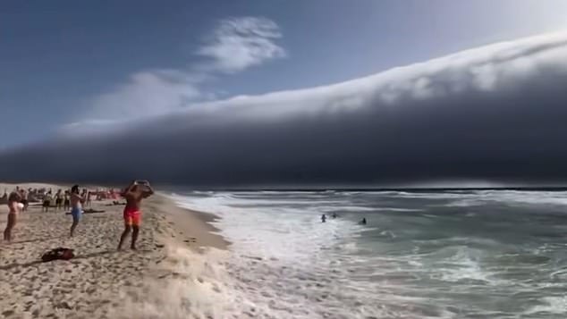
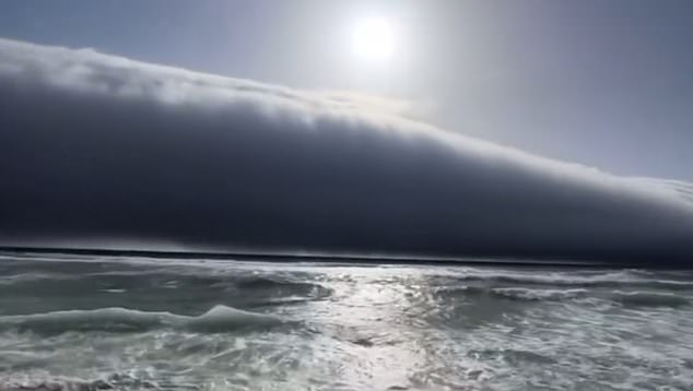
Beachgoers in Portugal were left terrified after spotting what appeared to a tsunami heading their way this week.
Images shared across social media showed a huge horizontal wall stretching from the horizon towards the shore, accompanied by a violent gust of wind when it reached land.
‘Felt like a tsunami out of a movie!’ one user tweeted, while another wrote: ‘If this isn’t the start of a disaster movie, I don’t know what is.’
Thankfully, this strange phenomenon was not a tsunami after all.
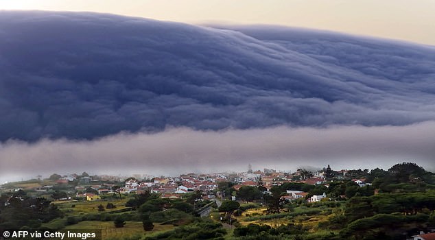
Instead, meteorologists have confirmed that this was a strange type of cloud known as a ‘roll cloud’.
Roll clouds – also known as arcus clouds – are low-level, wide ranging clouds that are typically associated with powerful storm clouds and thunderstorms.
‘Arcus clouds are spectacular low-level, long and thin clouds associated with powerful thunderstorms,’ the Met Office explained.
‘They are sometimes seen beneath Cumulonimbus clouds.’

Beachgoers in Portugal were left terrified after spotting what appeared to a tsunami heading their way this week

Images shared across social media showed a huge horizontal wall stretching from the horizon towards the shore, accompanied by a violent gust of wind when it reached land
What are roll clouds?
Roll clouds are one of two forms of arcus clouds – low-level, wide-ranging clouds that are usually seen alongside thunderstorms.
‘Shelf clouds are attached to the storm cloud, whereas Roll clouds are a horizontal column separated from the storm cloud,’ the Met Office explained.
How do roll clouds form?
The ‘roll cloud’ phenomenon is the result of a rare combination of air masses interacting with different temperatures and sea breezes.
‘When a cold downdraft from a cumulonimbus cloud reaches the ground, the cold air may spread rapidly along the ground, pushing existing warm moist air upwards,’ the Met Office said.
‘As this air rises, water vapour condenses into the patterns associated with Arcus clouds.
‘The new cloud may roll if it experiences different wind directions above and below.’

PORTUGAL: A rare ‘roll cloud’ advancing from the horizon towards the beaches of the Atlantic Ocean during the heatwave near Cabo da Roca, southwestern Portugal, on Sunday
What weather is associated with roll clouds?
Arcus clouds usually form with cumulonimbus clouds and downdrafts.
This means they tend to be associated with strong, gusty winds, heavy rain or hail showers, as well as thunder and lightning.
This was certainly the case in Portugal, where temperatures hit a record 46.6C, just days before the roll cloud appeared.
Where else have we seen roll clouds?
Roll clouds have previously been spotted in several locations around the world.
In March 2018, a colossal cloud was spotted above the sea off the coast of New Orleans, while just three months later, one was spotted in Tennessee.
Then, in July 2019, spectacular timelapse footage showed a roll cloud over County Mayo, Ireland.
And in December 2021, a massive roll cloud was caught off the coast of Melbourne, Australia.
