

More than 155 million Americans are under weather alerts Monday as an Arctic blast sweeps from the Midwest to the Northeast, bringing the first snow of the season and the coldest air of fall so far.
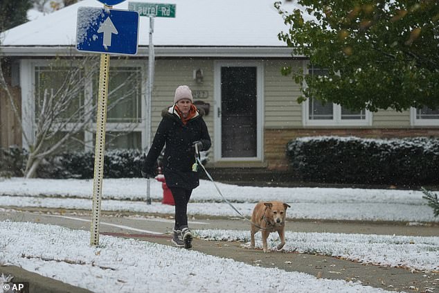
Snow is already falling from Michigan‘s Upper Peninsula to the Smoky Mountains, with icy air spreading deep into the South and East. Heavy lake-effect snow is piling up across parts of the Midwest and Great Lakes, while flurries stretch into the Appalachians, upstate New York, and northern New England through Tuesday.
One particularly fierce snowband dumped up to 12 inches of snow in just six hours over Momence, Illinois, a town about 50 miles south of Chicago.
Elsewhere, as much as 18 inches of buried areas south of Marquette, Michigan, while up to 10 inches was recorded across Michigan’s Leelanau Peninsula, just north of Traverse City.
Over the weekend, parts of northwest Iowa and southeast South Dakota also picked up around five inches of snow. Highs will stay stuck in the 30s across the southern Appalachians and in the 40s from the Northeast’s I-95 corridor down through Alabama, Georgia and Mississippi.
Several cities could break daily cold records, including Huntsville, Alabama (43°F) and Macon, Georgia (49°F).
Even the Carolinas and central Florida are not escaping the chill, with Charleston struggling to reach 50°F, about 20 degrees below average, while parts of Florida will barely make it into the 60s.
Jonathan Porter, AccuWeather Chief Meteorologist, said: ‘This storm pattern will introduce some of the coldest air seen for early November, and that is the reason for the robust snow amounts expected in the Great Lakes and the far southern extent of the flurries into the southern Appalachians.’

Millions of Americans are set to experience a freeze Monday night (PICTURED)
While the Chicagoland lake-effect snow should taper off by midday, heavier snow in the Lake Superior and Michigan snowbelts, from Upper and Lower Michigan into northern Indiana, will continue until late tonight.
Elsewhere, snow will shift southward through the Ohio Valley and Appalachians tonight. In the eastern Great Lakes, lake-effect bands could continue through Tuesday before possibly turning into brief lake rainbands on Wednesday.
In northern New England, rain could change to snow Monday night, with wrap-around snow lingering into Tuesday in some areas.
The heaviest additional accumulations could occur in the lake snowbelts from northwest Pennsylvania and southwest New York, south of Buffalo, up to New York’s Tug Hill Plateau, the Green Mountains of northern Vermont and the Appalachians of West Virginia, where over six inches of snow is possible.
Several more inches could also fall across the Ohio Valley and western Great Lakes snowbelts, including Michigan, Indiana, Ohio, northern Kentucky and the Smoky Mountains.
Morning lows could plunge into the 20s as far south as the Florida and Alabama Gulf Coast, with some 30s in northern and central Florida by Tuesday, bringing a widespread freeze across the Deep South.
Matt Devitt, chief meteorologist at WINK News, warned parts of Florida could get so cold on Monday that local iguanas could start falling out of trees, paralyzed by the freezing temperatures.
‘The iguanas are not dead, just temporarily stunned and immobilized from the cold…especially if it drops below 45°. Only in Florida!’ Devitt posted on X.
One particularly fierce snowband dumped up to 12 inches of snow in just six hours over Momence, Illinois, a town about 50 miles south of Chicago. Pictured is Northbrook, Illinois on Sunday
The cold could flirt with Veterans Day record lows in more than a dozen locations, including Savannah, Georgia (31°F), Mobile, Alabama (31°F) and Ft Myers, Florida (45°F).
For Tuesday, several locations could break record lows. Atlanta’s record for Tuesday is 26 degrees, and the low is forecast to reach around this point, meaning residents may need to drip their faucets overnight.
Even parts of Florida could see record lows, with cities as far south as Orlando and Tampa potentially tying lows of 39 and 40 degrees, respectively.
The Weather Channel warned: ‘This could be the coldest early November outbreak in Florida and other parts of the Southeast in 32 years, since a November 1993 outbreak produced a freeze in Gainesville, Florida, and plunged Birmingham, Alabama, to a frigid 24 degrees.’