
A sudden cold snap has triggered widespread freeze warnings across the central and eastern US, affecting nearly seven million residents from Wisconsin to North Carolina.
The National Weather Service issued alerts on Thursday, forecasting sub-freezing temperatures as low as 25°F in some areas, with the most severe impacts expected from midnight tonight through 9am ET Friday.
Portions of Illinois, Indiana, Iowa, Kentucky, Minnesota, North Carolina, Ohio, Virginia, West Virginia and Wisconsin are under warnings.
‘Frost and freeze conditions could kill crops, other sensitive vegetation and possibly damage unprotected outdoor plumbing,’ the NWS said.
‘Frost could harm sensitive outdoor vegetation,’ the warning added. ‘Sensitive outdoor plants may be killed if left uncovered.’
This early-season chill, driven by a broad high-pressure system ushering in Canadian.
It comes amid a broader autumn chill, with highs struggling in the 50s across the warned areas, 20 to 30 degrees below norms.
Travel disruptions are expected to be minimal so far, but black ice on rural roads could emerge post-freeze, according to the Illinois Department of Transportation.

A sudden cold snap is set to plunge temperatures to as low as 25°F
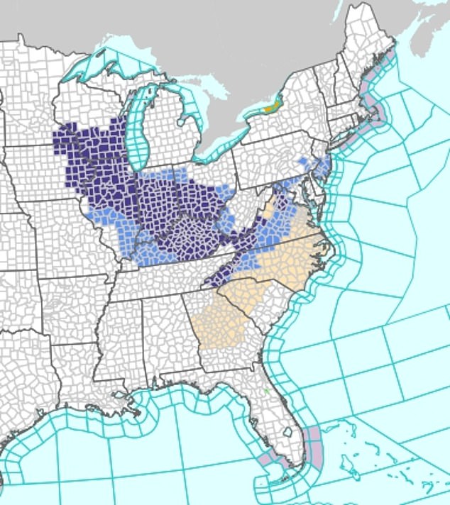
The National Weather Service issued the alert for 10 states, covering more than 200 counties
The freeze’s footprint spans more than 200 counties, stretching from the dairy-rich regions of Milwaukee and Dane in southeast Wisconsin to the mountainous terrain of Avery and Buncombe counties in western North Carolina.
Across central to west central Illinois, including Champaign, Cook (Northern), DuPage, Kankakee, and Peoria, temperatures are expected to plunge to 27–32°F.
In Indiana, lows between 28 and 31°F will spread across the northern, central, and southern regions, while northeast and southeast Iowa will see temperatures ranging from 25 to 31°F.
Kentucky faces lows of 29–32°F, with Rowan and Powell counties at risk of frost that could halt late vegetable plantings.
Southeast Minnesota braces for temperatures as low as 25°F, while Virginia’s Culpeper and Orange counties anticipate 31°F dips that threaten local vineyards.
In western North Carolina, temperatures could fall to 27–28°F, and parts of Ohio, including the central, southern, and southeastern regions, are forecast to reach around 31°F.
Further east, southwest to northwest Virginia expects 25–31°F lows, and West Virginia will hover near 31°F.
Across east central to southeast Wisconsin, temperatures are forecast to range from 26 to 34°F.
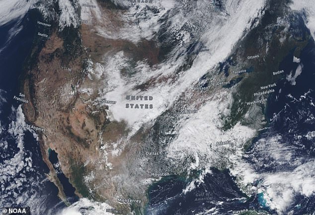
This early-season chill, driven by a broad high-pressure system ushering in Canadian
NWS officials are urging residents in affected areas to cover sensitive plants, insulate exposed pipes, and monitor local forecasts for updates.
The agency warned that additional cold fronts and storms could shift conditions, potentially triggering natural hazards.
These alerts aim to reduce agricultural losses and protect vulnerable systems as winter weather begins to settle over parts of the US.