Storm Melissa’s spaghetti model shows a wide and chaotic range of potential paths along the US East Coast.
Wednesday’s update highlights some tracks that could strike New York City, others that approach North Carolina and a few that reach New England.
These scenarios are relatively uncommon, representing up to 15 percent of ensemble members, and depend on specific atmospheric conditions, such as a strong trough steering the storm north along the coast.
However, the National Hurricane Center (NHC) reported this morning that ‘there is significant uncertainty in the track and intensity forecast of Melissa.’
For the North Carolina path, the model shows a possible landfall near Wilmington or the Outer Banks around October 29 or 31.
Tracks affecting New York are less frequent and more speculative, assuming the storm maintains strength after brushing or passing offshore of North Carolina and then moves along the coast near Long Island or New York City between October 30 and November 1.
For New England, the northernmost tracks depict Melissa as a post-tropical cyclone or weakening hurricane after passing New York, moving northeast toward Rhode Island, Massachusetts, or Maine between November 1 and 2, or remaining offshore while bringing rain and gusty winds.
Ben Noll, a meteorologist at The Washington Post, said on X: ‘People along the Eastern Seaboard should keep an eye on Melissa. Although direct impacts are currently unlikely, the longer the storm lingers in the Caribbean, the more unusual its journey north next week may be, as it could interact with another system.’
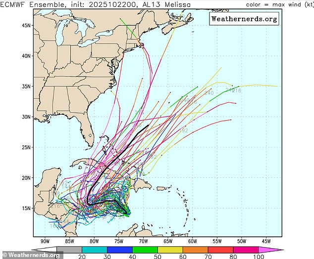
The latest forecasting models show several possible paths up the US East Coast, from North Carolina to New England
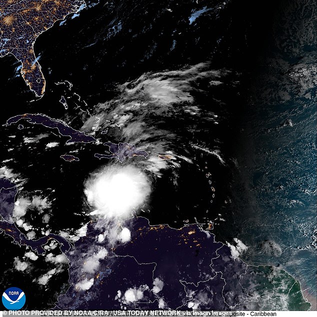
Tropical Storm Melissa is expected to reach hurricane status by the end of the week
The NHC said Wednesday that Melissa is expected to encounter moderate wind shear over the next few days, balanced by warm, moist air in the Caribbean Sea, a setup that could allow for slow strengthening.
The agency noted that while there is still ‘large forecast intensity uncertainty,’ the odds of Melissa becoming a major hurricane could rise if the storm tracks farther southwest, in line with some recent hurricane model forecasts.
Alex DaSilva, AccuWeather lead hurricane expert, said: ‘A dip in the jet stream over the Southeast US and strong upper-level winds are expected next week, which should prevent movement toward the Gulf Coast states.
‘The risk of direct impacts on the US is low at this time, but it cannot be ruled out.’
The slow-moving storm was located about 305 miles south-southwest of Port-au-Prince, Haiti, and some 335 miles southeast of Kingston, Jamaica. It had maximum sustained winds of 50mph.
A hurricane watch was in effect for southern Haiti from the border it shares with the Dominican Republic to Port-au-Prince, while Jamaica was under a tropical storm watch.
Melissa was expected to strengthen into a hurricane on Thursday and approach Jamaica and southwest Haiti later this week.
The spaghetti model relies on data from the European Centre for Medium-Range Weather Forecasts (ECMWF), one of the world’s most accurate forecasting systems.
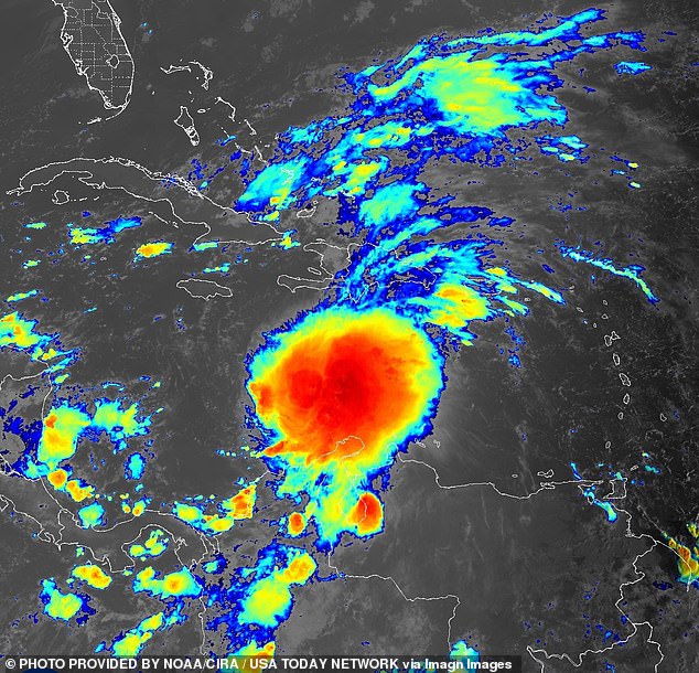
While the risk of a US landfall is low, meteorologists are warning that Melissa’s path could shift

A hurricane watch was in effect for southern Haiti from the border it shares with the Dominican Republic (pictured) to Port-au-Prince, while Jamaica was under a tropical storm watch
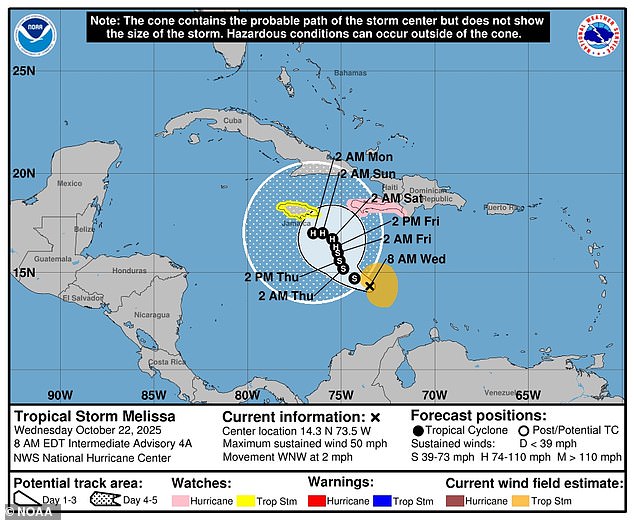
Melissa is expected to stay in the Caribbean Sea at least until next week
Short-range forecasts within one to three days are considered highly reliable, while projections beyond seven to ten days grow increasingly uncertain.
Most current ECMWF tracks show Melissa staying well away from the US in the near term. But some longer-range runs suggest possible paths up the East Coast toward the end of October and into early November.
After Melissa makes landfall in North Carolina, according to the model, some paths take the storm inland toward Raleigh, while others keep it hugging the coast.
A smaller number of forecast tracks extend toward New York, assuming Melissa holds strength after passing near North Carolina.
In this case, it could pass near Long Island or New York City, though most models keep it offshore. Even so, the region could see rain, gusty winds and coastal flooding.
Farther north, New England tracks show a weakening storm, likely post-tropical, reaching Rhode Island, Massachusetts or Maine next month.
Overall, about 70 to 80 percent of model tracks curve east into the Atlantic or dissipate over the Caribbean, suggesting low odds of US landfall.
Roughly 25 percent show possible impacts to the Southeast or Gulf, with North Carolina emerging as the most frequent northern target.
Officials urge residents along the East Coast to monitor NHC updates and prepare for possible coastal hazards if the storm trends closer to land in the coming days.
