
An iconic American city already sinking at an alarming rate now faces a fresh threat as a monster storm approaches the Gulf Coast, threatening heavy rain and flash flooding.
New Orleans is sinking by up to 2 inches a year as its marshy clay soil compresses under the weight of buildings.
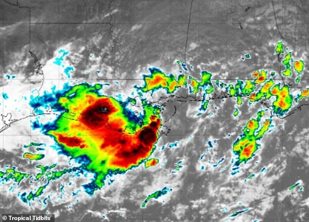
This ongoing subsidence is compounded now by a surge of tropical moisture brought by tropical weather system Invest 93L, increasing the risk of flash floods and putting additional strain on the city’s drainage systems.
‘Much of the infrastructure and drainage systems were designed for rainfall patterns typical of 50 to 100 years ago,’ Dan DePodwin, vice president of forecast operations at AccuWeather, told the Daily Mail.
‘It is not for the intense and extreme rainfall events we are experiencing right now.’
Forecasters are also monitoring the system as it moves north, dragging deep tropical moisture into the central US.
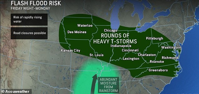
The National Weather Service (NWS) has predicted the system will churn through Arkansas by Saturday, then bring repeated thunderstorms to the Midwest and Ohio Valley into early next week.
This puts more than 30 million Americans across 11 states under the threat of flash flooding through the weekend.
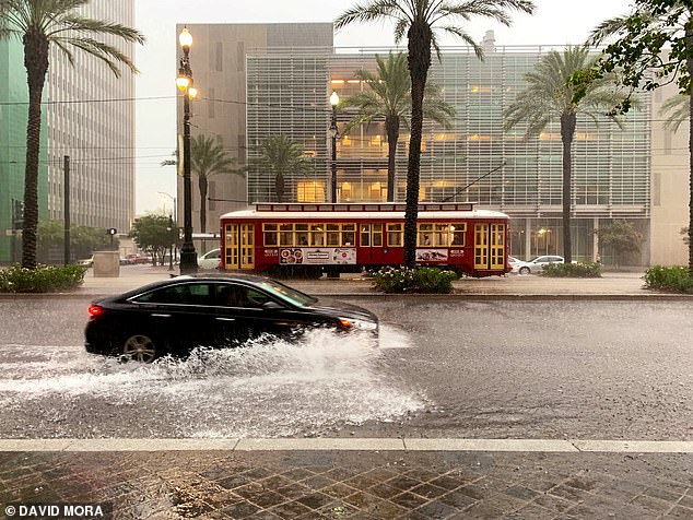
A major tropical rainstorm brought heavy rain to New Orleans (pictured), an area of the US that is sinking at a concerning rate (Stock Image)
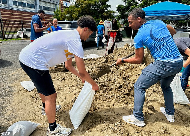
Volunteers filled sandbags for New Orleans residents on July 16, 2025, before heavy rains the Gulf Coast storm arrived
Areas south and west of New Orleans have been projected to be flooded with up to 8 inches of rain due to the storm
‘This has been a tremendously impactful and dangerous year,’ AccuWeather meteorologist Jonathan Porter said regarding nationwide flooding tragedies.
‘The number of flash flood reports this year to date has been a staggering 70 percent above the 10-year historical average.’
Earlier this week, the system dumped nearly 8 inches of rain in Pierre Part, over 6 inches in Little Woods and close to 6 inches in New Orleans’ Desire neighborhood.
On Friday, radar showed the storm’s core largely remaining south of New Orleans, with only light showers reaching the city. The worst of the weather stayed offshore.
The NWS lowered its rainfall forecast to a range of just 1.5 to 2 inches through Saturday, from an earlier prediction of 4 to 8 inches.
As of now, no street flooding has been reported in New Orleans or Jefferson Parish.
Alex DaSilva, AccuWeather’s lead hurricane expert, told the Daily Mail, ‘The tropical rainstorm, once labeled Invest 93L, has lost its structure. But leftover moisture is still capable of triggering localized flash floods across Louisiana through Saturday.’

New Orleans (pictured) is home to more than 360,000 people, but much of the city is below sea level
A Virginia Tech study has estimated that up to 225,000 people are at risk of death or displacement in sinking coastal communities (Stock Image)
Now pushing into the Midwest, the remnants of Invest 93L are colliding with a stalled weather front stretching from Iowa to West Virginia.
This setup is expected to bring repeated rounds of heavy thunderstorms through early next week, raising flash flood risks across parts of the Midwest, Ohio Valley and Appalachians.
According to AccuWeather, cities such as Chicago, Indianapolis and Pittsburgh could receive 2 to 4 inches of rain by Monday, with isolated spots potentially seeing over a foot.
‘The ample moisture from the tropical rainstorm is expected to be drawn northward,’ DePodwin said.
‘The flooding could be significant in places that have already been soaked this month.’
Experts warn that saturated soils and swollen creeks could lead to rapid water rises in some areas, especially where rainfall rates reach 1 to 3 inches per hour.
‘We’re increasingly concerned about the risk of flooding through the weekend as the moisture from this tropical rainstorm surges northward,’ DaSilva warned.
‘Some already waterlogged areas could receive another 4 to 8 inches of rain.’
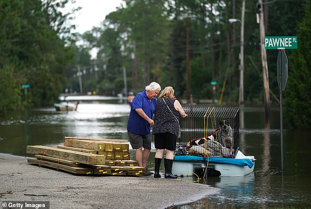
The tropical rainstorm impacting Louisiana also threatens to bring flash flooding to parts of the Midwest, Ohio Valley and Appalachians
Where rainfall rates reach 1 to 3 inches per hour, forecasters caution of ‘life-threatening flash flooding’, landslides and overwhelmed drainage systems.
Porter advised, ‘Don’t let your guard down. People should be prepared to move to higher ground if they receive a flash flood warning.’
Although Invest 93L never developed into a named storm, it has nonetheless caused widespread damage.
Meanwhile, forecasters are tracking another potential storm near the Gulf, which was expected to develop starting July 21.
The National Oceanic and Atmospheric Administration (NOAA) anticipates up to 19 named storms this season, including 10 hurricanes – of which, as many as five are expected to be categorized as major – that could impact the US.